The Satellite World Map Like No Other
Discover how PlanetSAT satellite world map has evolved over 20 years, providing seamless global imagery for various industries.
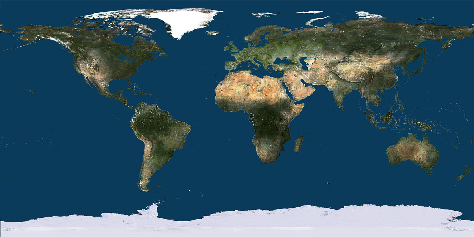
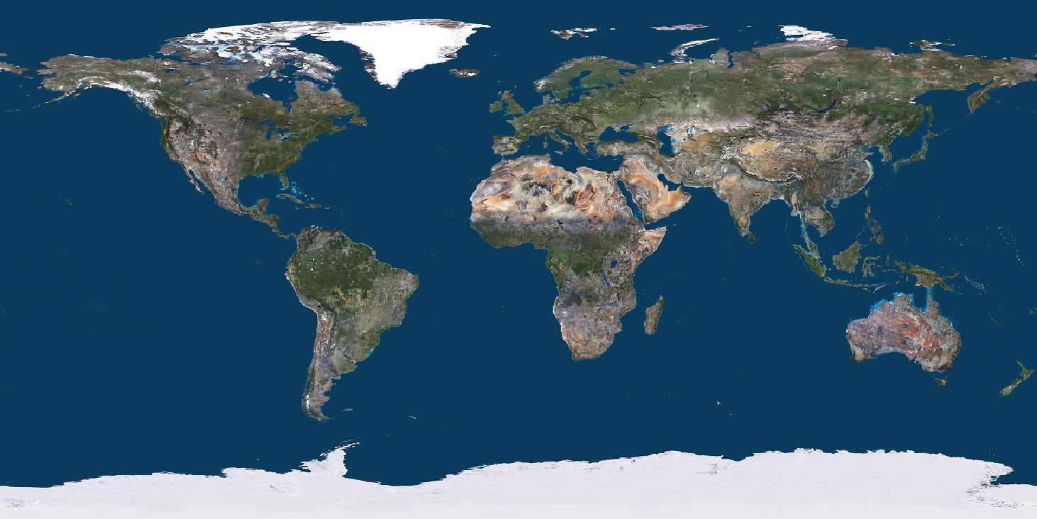
In January 2025, we launched our new and improved free online viewer featuring PlanetSAT satellite world map. With new display features, including globe and flat earth views, users can explore our high-quality satellite imagery like never before.
But how has PlanetSAT satellite world map evolved over the years to achieve its current level of realism?
To answer this question, let’s take a look at its journey from early satellite data to becoming the trusted world map used by industry leaders such as Thales, Dassault and its subsidiary Sogitec, Boeing, the Meteorological Services of New Zealand, the BBC, and RSA Cosmos, among others.
The Origins of PlanetSAT Satellite World Map
How did we build a detailed, global satellite map? The journey of PlanetSAT began more than 20 years ago with a world map at 150-meter resolution, created using Landsat 5 imagery data.
Landsat 5, launched in 1984, provided 30-meter resolution imagery of the Earth’s surface. We later leveraged Landsat 7 data, which included a 15-meter panchromatic band, enhancing the level of detail.
A key milestone was reached in 2008, when we released our first 15-meter resolution world map, processed from 8,850 Landsat 7 scenes—a major breakthrough in global satellite mapping at the time.
France imagery at 5-meter resolution is also included, allowing you to explore the country in greater details. This is a beta test of 5-meter super resolution processed with AI from PlanetSAT 10-meter imagery. Be kind, there’s still room for improvement as we refine this feature!
In addition to high-quality imagery, we’ve introduced more fluid navigation, ensuring a smooth and intuitive experience whether you’re zooming in on a specific location or flying over continents and regions.
Advancing with Cloud-Free Updates obe and Flat Earth
The launch of Landsat 8 in 2013 further improved the global imagery. With its 15-meter panchromatic and 30-meter multi-spectral resolution, along with a 185 km swath, it allowed for significant updates to PlanetSAT world map.
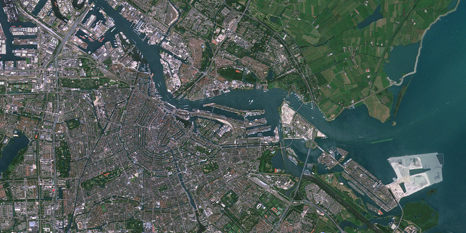
In 2014, we incorporated Landsat 8 data for all major cities in Europe, the Middle East, and Asia, while also reducing cloud cover across large regions.
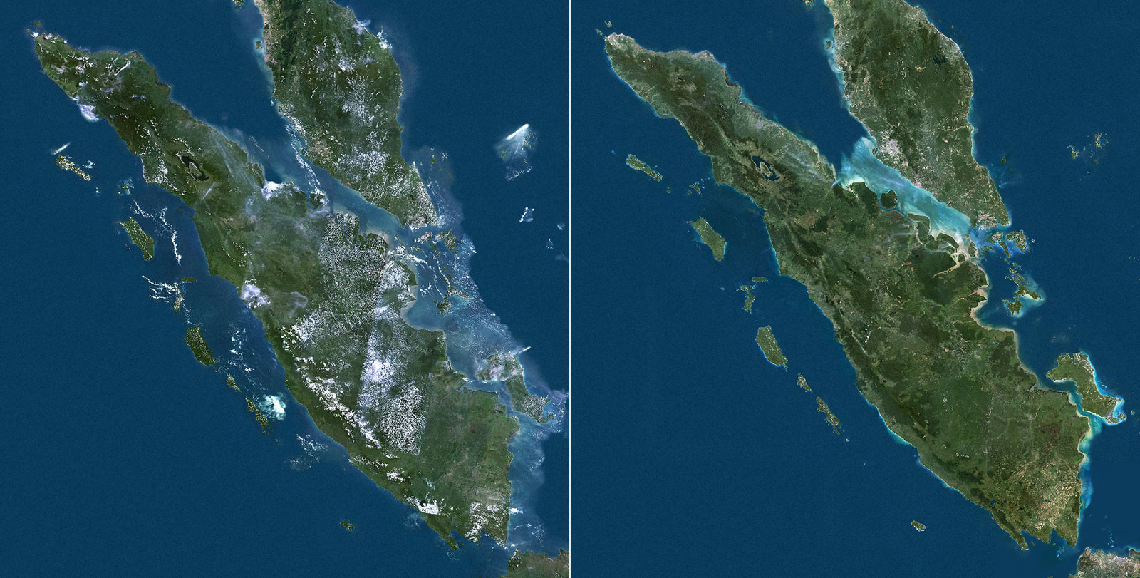
Creating a virtually cloud-free map was one of the biggest challenges, especially in tropical areas, where cloud cover is persistent year-round. However, we successfully produced a clear, seamless map, even in highly challenging regions like Indonesia.
A Turning Point: the Move to 10-Meter Resolution
A major move forward came with the availability of Sentinel-2 imagery, offering a 10-meter resolution.
The European Space Agency launched Sentinel-2A in 2015, followed by Sentinel-2B in 2017, providing frequent, high-quality Earth observation data.
In 2018, we integrated Sentinel-2 imagery for over 500 major urban areas worldwide, enhancing detail and clarity. From that point on, PlanetSAT satellite world map updates became fully processed at 10-meter resolution with Sentinel-2 imagery, delivering a more immersive and precise experience.
A key factor in maintaining the high quality of PlanetSAT satellite world map is our structured production program, which enables us to release a new version every year.
Started 10 years ago, this program ensures the continuous update of major cities, large populated regions, and key industrial sites.
Additionally, we integrate new satellite mosaics for entire countries, enhancing coverage and accuracy. By systematically refreshing our data, we provide users with an up-to-date and visually consistent world map for a wide range of professional applications.
Key Features of PlanetSAT World Map:
– Cloudless updates for a seamless viewing experience
– Advanced color balancing for natural and realistic visuals
– Efficient seamless processing for uniform global coverage
Explore PlanetSAT 2024, the latest world map version, on our online viewer! The 2025 version will be released in March, bringing even more refined updates. Follow our updates to explore the latest enhancements!
Use Cases: How Industries Benefit from PlanetSAT World Map
Thanks to its unique combination of global coverage, clarity, and consistency, PlanetSAT satellite world map serves a variety of industries:
– Defense & Aerospace – Used in mission planning systems, moving maps, and flight simulators by leading companies such as Thales, Dassault, and Boeing.
– Mapping & GIS – Enhances cartography, geographic analysis, and interactive mapping applications, including Cartes IGN.
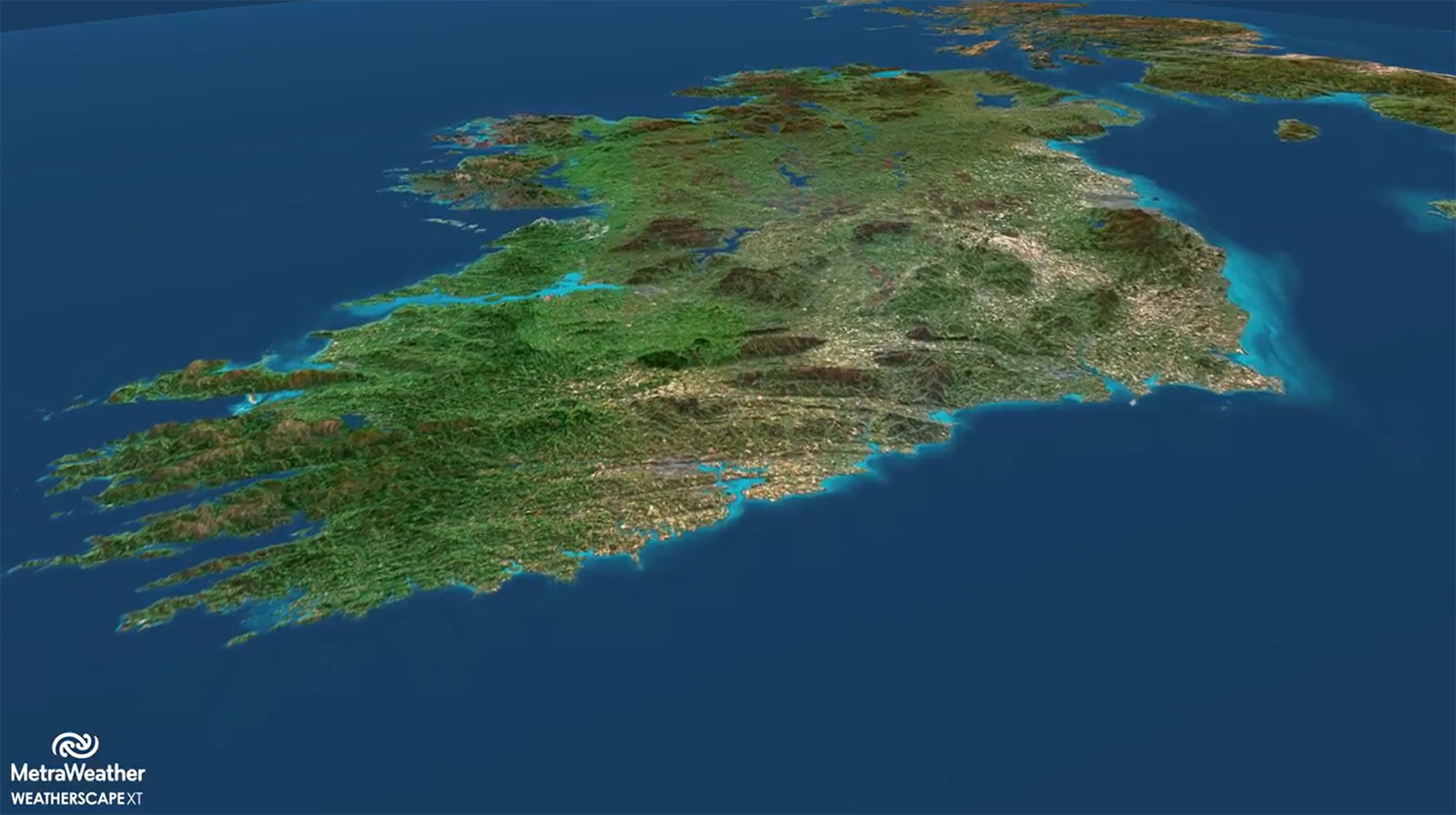
– Broadcast & Weather Solutions – Powers TV weather graphics and meteorological platforms, as seen in solutions from MetraWeather and Chyron for the BBC.
– Planetariums & Museums – Enables immersive Earth visualizations for RSA Cosmos planetariums.
The Future of PlanetSAT
For over two decades, PlanetSAT satellite world map has evolved to provide high-quality, seamless global imagery. From Landsat to Sentinel-2, each advancement has contributed to making PlanetSAT an essential tool for defense, aviation, broadcasting, and more.
With annual updates and continuous improvements, PlanetSAT world map remains the go-to solution for professionals who need a high-quality satellite basemap.
Looking ahead, new large regions will be refreshed with the latest Sentinel-2 data, focusing on North America, Europe and Asia. These updates will reflect recent developments, ensuring that users always have access to the most current and detailed imagery.
Beyond geographic updates, our commitment is to consistently enhance PlanetSAT by further reducing the small remaining cloud cover. While our basemap is already virtually cloud-free, we continue refining our techniques to eliminate persistent clouded areas, particularly in tropical and mountainous regions. By maintaining this high quality standard, PlanetSAT will continue to offer a clear, seamless, and reliable global imagery solution for all users.
Check out PlanetSAT 2024 on our online viewer and stay tuned for the 2025 release in March!