Defence and Intelligence Solutions
Trusted Geospatial Data for GeoINT Success
Strengthen Defence Operations with Reliable Geospatial Data
Access accurate, ready-to-use satellite imagery and elevation data to support critical Defence and Intelligence operations. Designed for seamless integration, our geospatial data ensures reliability, situational awareness, and operational effectiveness in every mission.
With consistent global coverage, our geospatial data helps defense professionals build precise, high-impact solutions—quickly and with confidence.

Geospatial Data in Action:
From Simulation to Command & Control

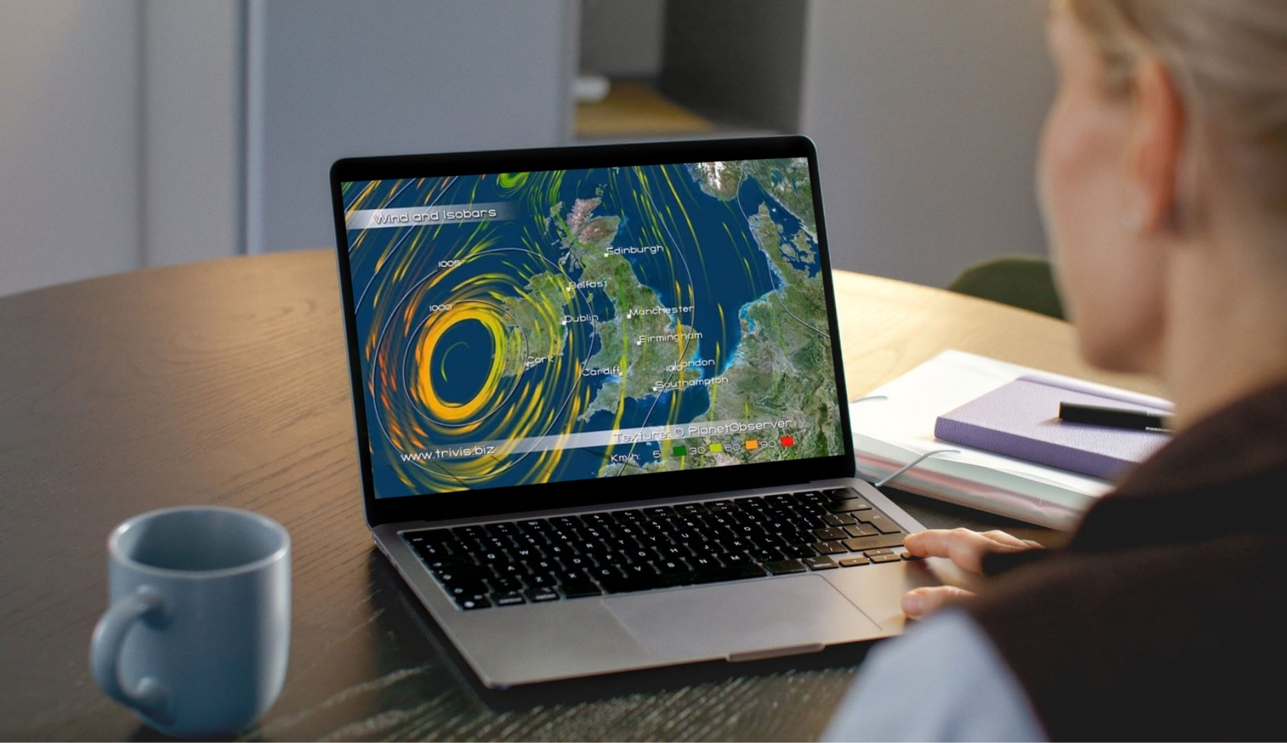
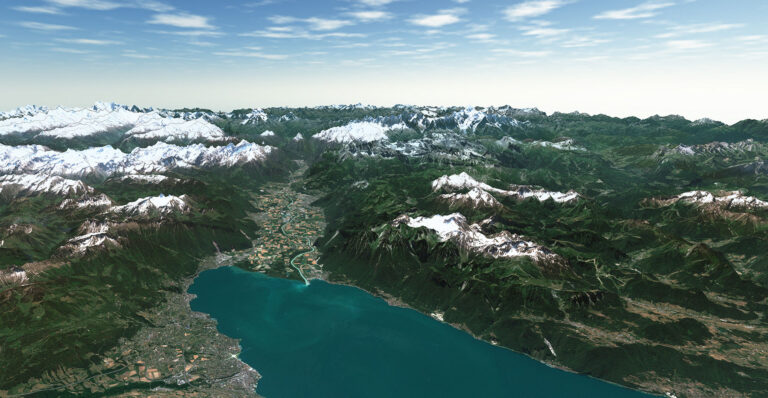
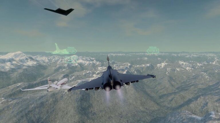
Optimized Data for Simulation And Training Systems
Deliver ultra-realistic simulation and training experiences with the most consistent and comprehensive geospatial data available for defence and intelligence.
Our high-quality 10-meter satellite imagery and 30-meter elevation model with global coverage enable the creation of accurate, immersive 3D environments—boosting performance and mission readiness.
Key Applications
- High-fidelity environment creation and visualization
- Synthetic training environments
- Flight simulation—from global scenarios to tactical zones
Integrate with confidence our natural-color imagery and reliable elevation data into your simulation & visualization solutions. Perfectly suited for advanced simulation systems, including Full Flight Simulators (FFS), where realism, consistency, and reliability are essential.


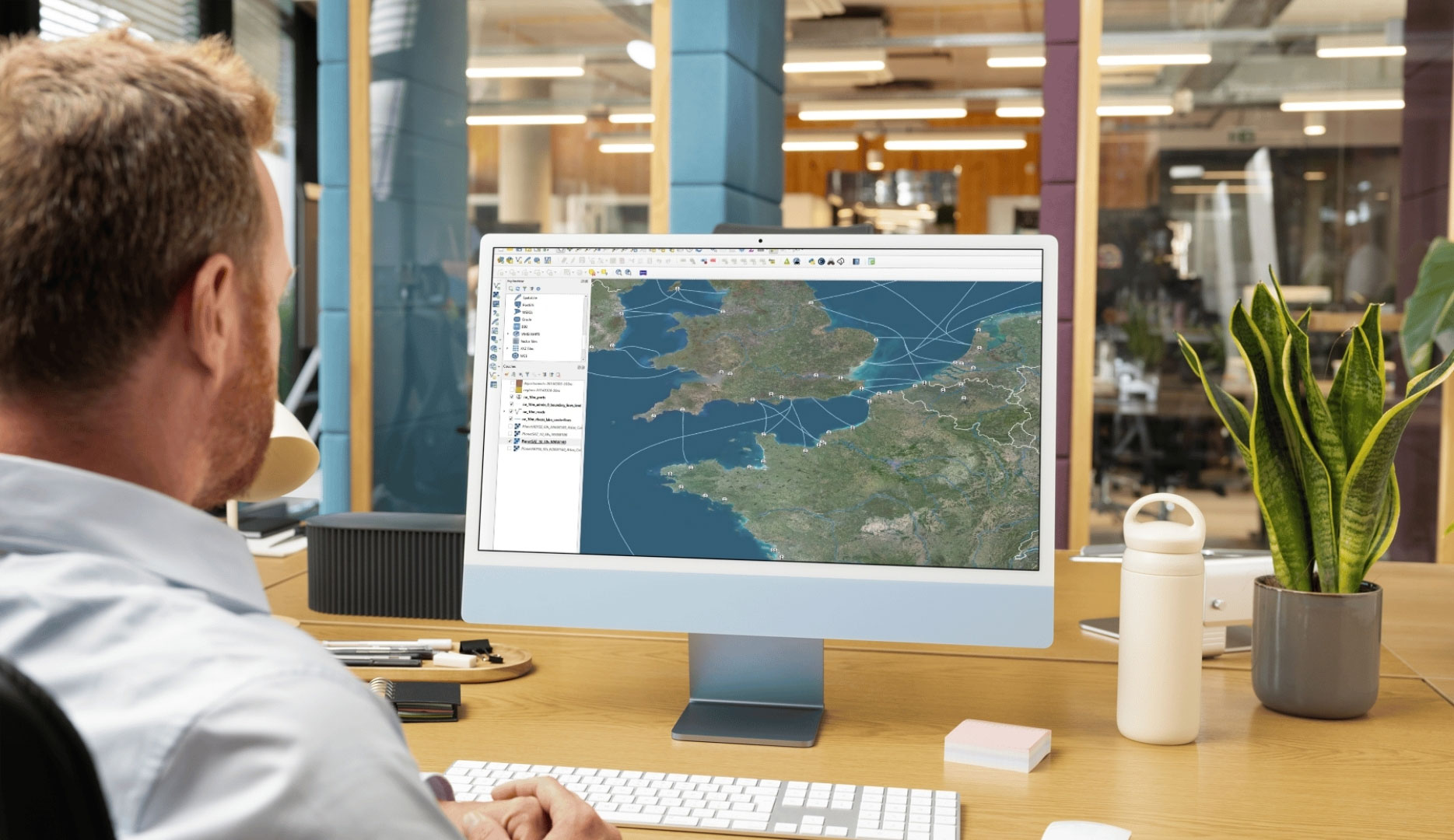
Reliable Geospatial Data for Command & Control
Empower defense and intelligence operations with the seamless integration of our high-quality geospatial data into C4 systems (Command, Control, Communications, and Computers).
Enhance situational awareness, accelerate decision-making, and ensure superior command and control of forces—anywhere in the world.
Key Applications
- Strategic visualization of large theatres of operation
- Advanced mission planning and execution
- Real-time mission management systems
- Navigation and visualization solutions for complex environments
Gain a decisive edge with our optimized terrain data designed for wide-area visualization and the creation of accurate, immersive 3D environments across mission preparation systems.

Our Commitment
Trusted geospatial solutions—delivered with precision and care.
Expert support
We go beyond data delivery—offering close collaboration to ensure our solutions align with your goals and technical needs.
Let's talk
Ready to enhance your Defence and Intelligence solutions?
Contact us to explore how our data can support your project.
Hear What our Amazing Customers Say
« PlanetObserver datasets are used across multiple Thales GBUs with excellent results. Their reliability, consistency, and ease of use make them valuable assets for a wide range of military and civil applications. »
– Thales
« PlanetDEM global elevation dataset provides the reliable, high-quality terrain data our Defense clients expect for critical simulation, mapping, and mission planning projects worldwide, with seamless integration and consistent results. »
– L3HARRIS
« By integrating PlanetObserver geospatial data into Terra Vista, we deliver a more immersive and accurate simulation experience that enhances decision-making and readiness for all military use cases. »
– Agenium
They trust us
Customer Success Stories
See how organizations around the world use our geospatial data to solve real challenges, drive innovation,
and bring their projects to life. Discover their stories—and imagine what’s possible for yours.


PlanetObserver’s 2D and 3D data boost Digital Moving Maps for situational awareness in civilian and military use.
Discover how PlanetSat imagery and PlanetDEM elevation data enhance Terra Vista with high-quality 3D terrain simulation imagery.

A key challenge for Defense is obtaining accurate medium-resolution imagery and elevation data for a reliable terrain view.
PlanetSAT basemap enriches flight simulation solutions with vivid imagery, enhancing user experience & training.
Let's talk
Ready to enhance your Defence & Intelligence solutions?
Contact us to explore how our data can support your project.