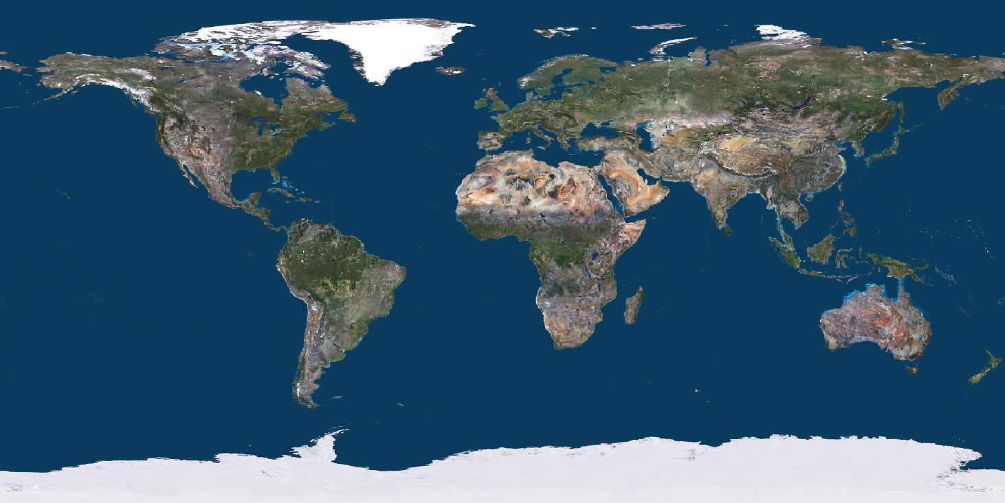
PlanetObserver Releases PlanetSAT Imagery Basemap 2025 with Expanded Updates
Discover PlanetSAT Global Basemap 2025, an advanced imagery basemap with updated coverage, refined colors, and seamless detail.
Clermont-Ferrand, France – March 25, 2025 – PlanetObserver, a leading provider of high-quality geospatial data, announces the release of PlanetSAT Imagery Basemap 2025, the latest edition of its premium satellite imagery basemap.
This new version brings expanded geographic updates, enhanced color consistency, and improved seamless integration, further strengthening its value for mapping, simulation, and Geographic Information Systems (GIS) applications.
Key Updates in PlanetSAT Imagery Basemap 2025
This year’s new edition of PlanetSAT basemap offers the following updates:
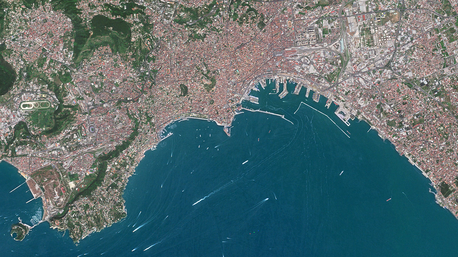
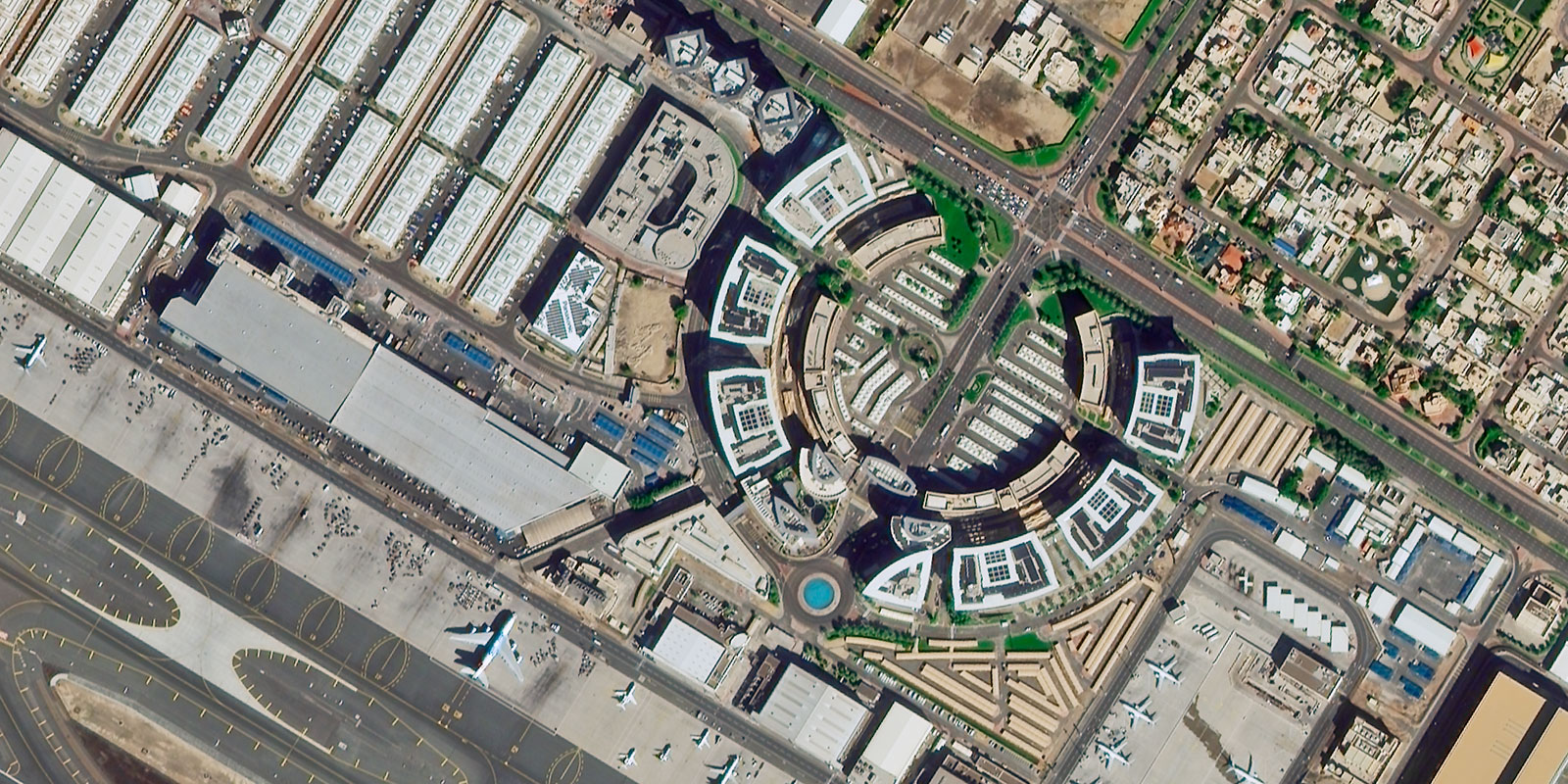
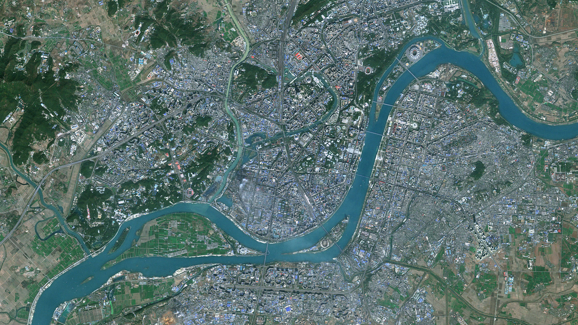
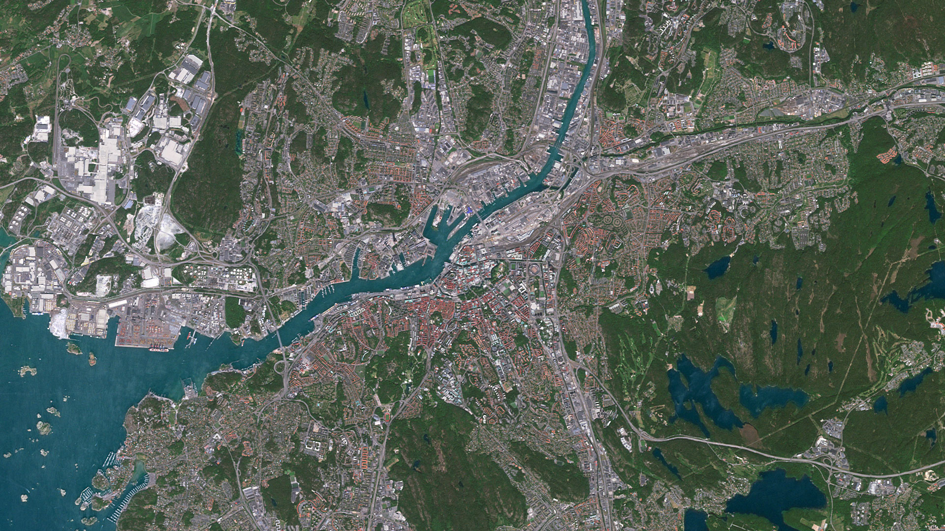
• Expanded Imagery Updates: The 2025 edition features the latest satellite imagery updates across all Scandinavia, the Korean Peninsula, India, Ukraine, and Central Asia, , with over 12 million km² of refreshed data, ensuring the most recent and visually accurate representation of these regions.
• Major Urban Area Refresh: More than 120 major cities worldwide have been updated with the most recent imagery, providing more detailed views for urban planning, visualization, and simulation applications.
• Enhanced Color Consistency and Seamless Data: PlanetObserver has further refined its proprietary processing techniques to achieve even greater color harmony and seamless mosaicking, ensuring a natural and realistic visual experience across the entire basemap.
With these improvements, PlanetSAT Imagery Basemap 2025 continues to offer aesthetically superior, cloud-free satellite imagery designed to support a wide range of professional applications, from mission planning and flight simulation to cartography and GIS solutions.
A Reliable and Ready-to-Use Imagery Basemap
PlanetSAT Imagery Basemap 2025 is a turnkey solution, providing up-to-date and consistent imagery ready for immediate integration into professional mapping platforms and simulation systems. With its unique expertise in satellite imagery processing, PlanetObserver ensures a seamless, color-balanced dataset that enhances visualization and decision-making.
“We are proud to introduce this latest version of PlanetSAT Imagery Basemap, which continues to evolve with expanded updates and refined image quality,” said Laurent Masselot, CEO of PlanetObserver. “Our goal remains the same: to provide users with the most beautiful, reliable, and user-friendly satellite basemap for their projects.”
Available Now
PlanetSAT Imagery Basemap 2025 is available for licensing worldwide. It is offered in various formats, including GeoTIFF (native format), Cloud Optimized GeoTIFF (COG), and JPEG 2000, for an easy integration into mapping platforms, GIS software, and simulation environments.
Explore the latest version of PlanetSAT 2025 and experience its outstanding quality. Check it out now on our online viewer for a seamless and immersive preview of the updated basemap. Discover how its expanded updated coverage and enhanced visual consistency can elevate your projects.
About PlanetObserver
For over 30 years, PlanetObserver has specialized in the production of high-quality global satellite imagery and elevation data. The company provides ready-to-use, seamless, and visually stunning geospatial data to clients in defense, flight simulation, mapping, broadcasting, and GIS industries worldwide.