Products
Industries
Resources
Explaining your tech job at a family gathering? Let us spice it up with our very own survival guide!

Ever find yourself stuck at a family gathering, trapped between Aunt Gertrude's infamous tuna casserole and Cousin Eddie's endless questions about your job? Welcome to the world of working at PlanetObserver, where explaining what we do turns into a comedy routine faster than you can say "satellite imagery." Let's set the scene:
You: "I work at a company that sells global mosaics of satellite imagery of the world."
Cousin Eddie: "So, like Google Maps?"
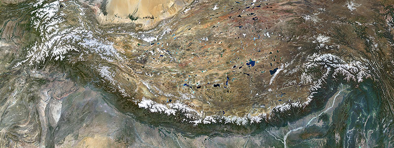
You (chuckling): "Not exactly! Our imagery is so good it makes Google Maps look like a kid's doodle! We mainly work with medium resolution imagery, so you can see main avenues but can't zoom in to count the leaves on a tree."
Cousin Eddie: "But I love zooming! The more zoom, the better, right?"
You (grinning): "Not necessarily. It's like putting ketchup on fine dining - sometimes less is more."
Cousin Eddie (confused): "Who buys them, then? And what do they use it for?"
You (giving up): "Pass the casserole, please."
That's right, folks. Our day jobs have turned into a punchline at parties. So, we've decided, as a team, to finally put an end to these kinds of conversations that ruin our time with friends and family (and our appetites).
Sit back, grab a snack (hopefully not tuna casserole), and let us collectively answer the million-dollar question: "What on Earth is PlanetSAT for?"
Ever played one of those flight simulation games and wondered why the mountains look real, but your piloting skills don't? That's where PlanetSAT comes in! Our satellite imagery is like the makeup artist for flight simulations, turning ordinary landscapes into red-carpet-worthy terrains for both civilian wannabe pilots and military hotshots.
Your nephew's favorite game, that flight school down the street, and even secret military training bases – they all need our stylish virtual views.
So next time someone tells you flight simulation is just playing around, remember that at PlanetObserver, we're making piloting look first-class! Just don't ask us to improve your piloting skills – that's above our pay grade!
Ever wonder how James Bond always knows where the bad guys are? That's right, he probably uses PlanetSAT (no confirmation, but we can dream, right?). Our imagery assists military and intelligence agencies in keeping tabs on the world, without having to wear a tuxedo or drive an Aston Martin. Though we must admit, that would be pretty cool.
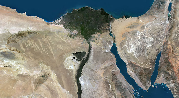
You know those mesmerizing maps you stare at on a long flight, tracking your progress from New York to Timbuktu? That's PlanetSAT's handiwork! We provide imagery that keeps you entertained when the movie selection is a bust.
Picture this: You're on a plane, tapping your screen, and suddenly you find yourself tracking your flight over colorful landscapes and winding rivers. That's us! We don't just show you where you are—we make you wish you had a window seat!
Now, should you stumble upon a crappy image that looks like it was drawn by a squirrel with a crayon, don't blame us because it certainly is not PlanetSAT.

The energy industry loves PlanetSAT. Why? Because our imagery helps them find the best places for wind farms, solar panels, and other renewable energy sources. Imagine planting a sunflower in your garden, but instead of a flower, it's a solar panel, and instead of a garden, it's a desert. That's PlanetSAT's role in energy, minus the gardening gloves and muddy boots.
Cousin Eddie, we've all been there – that time you took a wrong turn and ended up at a zoo instead of Grandma's house. (Honestly, who can tell the difference sometimes?) because you used that old paper map, and it looked like a toddler's crayon masterpiece? Well, PlanetSAT is like the grown-up version of that map, but without the crayon marks and the mysterious coffee stains.
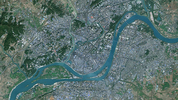
Think of PlanetSAT as the big, beautiful picture in the background of your GPS. Our satellite images make the roads, rivers, and landmarks pop out, so even Aunt Gertrude‘s squinting eyes can make sense of the world.
So, next time you're using a mapping platform, know that PlanetSAT's there, like a trusty co-pilot.
Now to answer Cousin Eddie’s question: what's the big fuss about PlanetSAT?
Well, imagine trying to read a book by shoving it right up against your nose – too close and all a blur. Now picture holding it out at arm's length – too far to make out the words. PlanetSAT's medium-resolution imagery is like holding the book just the right distance from your face – not too close, not too far, but just right! We're like the reading glasses of the satellite world. We collaborate with all sorts of industries, making life a little less blurry and a lot more efficient.
Now pass the casserole please.
Oh, and dear readers, we hope our stories might give you a chuckle and some ideas for the next time you need to explain your tech job to your family – no matter which tech industry you’re in. Think of it as a friendly nudge to make family get-togethers less about avoiding tricky questions and more about having a good laugh together!