Products
Industries
Resources
PlanetObserver introduces PlanetSAT 2024, the newly updated 10-meter Global Basemap

CLERMONT-FERRAND, France – April 16, 2024 – PlanetObserver, a prominent supplier of geospatial data, is thrilled to unveil the PlanetSAT Global Basemap 2024. This 10-meter global basemap offers up-to-date, cloud-free, and consistent imagery for a large range of applications.
PlanetSAT Global Basemap 2024 brings you a range of enhancements that empower professionals across diverse fields.
Over 6 million square kilometers of new Sentinel-2 imagery have been integrated into PlanetSAT 2024, with updated regions spanning from Europe to North America, in addition to various other locations around the globe:
· United Kingdom and Ireland: The British Isles have been completely refreshed with the latest Sentinel-2 imagery, providing an entirely cloud-free and homogeneous coverage.
· USA, Mexico, and Southern Canada: Full coverage with new 10-meter Sentinel-2 imagery now extends across these key North American territories.
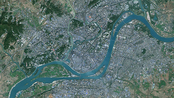
· 100+ Cities Updated: Urban areas across the world are captured with greater detail, offering more recent and reliable views.
· 30 Updated Points of Interest: From mining operations to solar farms, PlanetSAT Global 2024 includes critical industrial features refreshed with Sentinel-2 imagery.

Building upon the success of the sharpness filter introduced in the 2023 version, PlanetSAT 2024 maintains this feature. Users can continue to explore our planet with enhanced clarity.
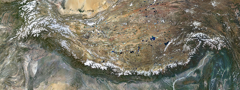
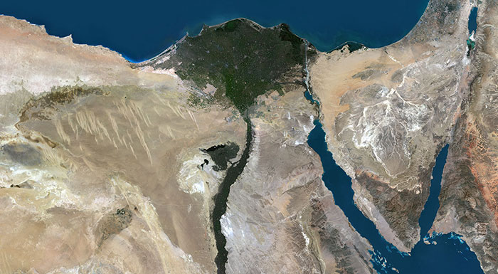
PlanetSAT 10m imagery basemap offers an impressive cloud-free coverage of over 95% across the Earth's surface, with only scattered cloud cover remaining in tropical regions. Our unique methodology leverages seasonal data to procure the best cloud-free imagery for each continent. Unlike common practices that alter cloudy areas' colors to create a uniform appearance, our approach prioritizes data integrity.
At each annual update, we meticulously source and integrate 100% cloud-free imagery into the basemap. This commitment ensures that our clients receive accurate and up-to-date geographic information, even in regions with complex cloud dynamics.

In PlanetSAT 2024, we maintain a dedicated commitment to seasonal uniformity, ensuring that selected images capture the vivid colors of spring and summer. By strategically choosing imagery from these seasons, we guarantee a seamless transition and consistency in colors throughout the entire basemap. This meticulous approach not only enhances the visual appeal but also offers a more unified understanding of geographic features across diverse regions.
PlanetSAT Global 2024 uses the latest Sentinel-2 data to deliver a unified and detailed representation of the Earth, down to a 1:50,000 map scale. With a 10-meter resolution, the basemap is tailor-made for diverse applications such as mapping, visualization, planning, and informed decision-making across various sectors.
Having processed over 250 trillion pixels since our first global basemap back in 2003, our annual updates ensure the delivery of a visually appealing and cloudless global basemap.

PlanetSAT Global combines advanced image processing techniques and meticulous color balancing methods to seamlessly merge countless individual scenes, creating a continuous and consistent global view. This global basemap is specifically designed to enhance mapping and visual simulation solutions.
At PlanetObserver, we prioritize delivering a high-quality, ready-to-integrate basemap that seamlessly integrate into a variety of project workflows. Our PlanetSAT Global basemap is conveniently available in a range of professional formats, including GeoTIFF, JPEG 2000, and COG, tailored to meet the diverse needs of our clients.
Whether your project demands comprehensive global coverage or a more targeted continental, national, or custom Area of Interest (AOI) coverage, PlanetSAT Global Basemap provides the flexibility and adaptability essential for your projects.
PlanetObserver offers an interactive world viewer, accessible for free on our website. This user-friendly tool, featuring the PlanetSAT 2024 Global basemap, allows both casual users and industry professionals alike to seamlessly navigate the world. This gives users the opportunity to explore any place on Earth with full clarity at a 10m resolution!
PlanetObserver is a French company located in Clermont Ferrand, dedicated to providing high value-added geospatial data. Our mission is to empower professionals worldwide with reliable and up-to-date imagery, enabling comprehensive interpretations alongside a deeper appreciation of our planet’s beauty.
Every product from PlanetObserver is crafted in-house, illustrating our extensive capabilities in geospatial data processing and portraying over three decades of expertise in the industry. Our experience and expertise have solidified our role as a trusted provider and collaborator for top-tier firms across Europe, North America, and the Asia-Pacific region.
Learn more about PlanetSAT Global 2024