


Capabilities of PlanetObserver - Part 5: Ready-to-Use Geospatial Data
Explore how PlanetObserver’s customized geospatial data solutions cater to the unique needs of various industries.
In the fast-evolving world of geospatial technology, delivering user-adapted data that seamlessly integrates into existing solutions is crucial. At PlanetObserver, we provide ready-to-use geospatial data tailored to the unique needs of our diverse clientele. This fifth and final installment of our “PlanetObserver Capabilities” series showcases how our data solutions serve clients across various industries.
Adapting Geospatial Data to User Needs
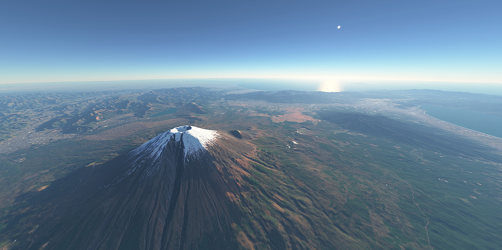
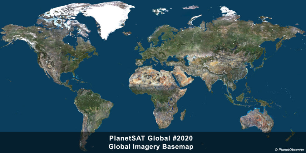
Leading flight simulation providers, like Boeing, Sogitec, and Thales, required realistic and global imagery for flight simulation and training. PlanetSAT 10m imagery basemap provided the necessary precision and realism, seamlessly integrating into their existing systems and significantly enhancing the quality of simulated environments.
Display Interactive aimed to transform their in-flight moving maps into an immersive visual experience for airline passengers. They integrated PlanetObserver’s PlanetSAT natural color global imagery into their UGO PAX and UGO 360 inflight entertainment solutions (IFE), enriching the visual quality of the maps and offering passengers an engaging exploration of their flight route.
At Temple University Rome Campus, architecture students needed detailed satellite images of the Tiber River for a project. Existing sources lacked the necessary resolution. PlanetObserver provided 30cm Very High Resolution (VHR) imagery from the BJ-3 satellite distributed by Onyx Space, enhancing the quality of their research and delivering easily integrated data.
Those examples demonstrate how PlanetObserver serves a wide range of industries, from defense, aviation to entertainment. We tailor our solutions to meet the unique needs of each sector. For the defense industry, our data delivers accurate and secure information for mission planning, and flight simulation and training. In entertainment and media, our data enhances visual experiences in movies, planetariums, and virtual reality, while also supporting press, publishing, and broadcasting. With our flexible approach and focus on customer needs, PlanetObserver continues to be a trusted partner across industries, providing customized solutions on a global scale.
Ready-to-Use Geospatial Data Solutions
At PlanetObserver, our ready-to-use geospatial data solutions are designed to seamlessly integrate into various applications, ensuring that our clients can leverage our data effectively and efficiently. Our solutions focus on three key aspects:
1. Seamless Integration
Our geospatial data is crafted for easy integration into existing systems. We understand that our clients operate in diverse environments with unique technological frameworks. Therefore, we ensure that our data products are compatible in terms of format, tiling structure and projection with a wide range of platforms and software, minimizing the need for additional adjustments.
As an example, PlanetSAT 10-meter basemap, PlanetObserver’s flagship product, is available off-the-shelf in diverse standard formats, including GeoTIFF, COG (Cloud Optimized GeoTIFF), and JPEG 2000. The GeoTIFF format, widely used throughout the geospatial and earth science communities to share geographic image data, ensures compatibility with various software and platforms. The Cloud Optimized GeoTIFF (COG) is specifically designed for efficient workflows in cloud environments, making it ideal for mapping platforms.
Additionally, JPEG 2000, a compression standard, offers improved compression performance over traditional JPEG, enhancing data storage efficiency. All these formats comply with OGC standards (Open Geospatial Consortium) and seamlessly integrate into all standard professional solutions.
2. Tailored Solutions
Every project has its specific requirements, and a one-size-fits-all approach rarely works. At PlanetObserver, we are committed to delivering customized solutions that address to the unique needs of our clients. Whether it’s for in-flight entertainment, or advanced flight simulation, our geospatial data is tailored to meet the exact specifications and technical requirements of each use case. We collaborate closely with our clients to understand their objectives and deliver data that match their expectations.
For example, our 10-meter imagery mosaic is often adapted into various formats and projections to suit specific use cases. For a client specializing in cybersecurity solutions, we supply PlanetSAT imagery along with its annual updates in OpenStreetMap (OSM) format each year, covering different zoom levels down to level 14, for seamless integration into their solution.
Similarly, for MetraWeather’s weather graphics platform, we customize and merge PlanetSAT 10m imagery with PlanetDEM 30m elevation data to create specialized maps tailored to their needs.
We leverage several tools to customize our datasets, with Global Mapper standing out as one of the most essential. This advanced GIS software is crucial for viewing, merging, importing, and exporting a wide range of vector, raster, and elevation data. Global Mapper’s versatility lies in its extensive suite of spatial data processing tools and its ability to support a broad range of data formats, making it an indispensable asset in our workflow.
3. Commitment to Reducing Additional Processing on Client’s End
One of our core principles is to reduce the need for additional processing on the client’s end. By delivering data that is already formatted, adjusted, and ready to use, we help our clients save valuable time and resources. This simplified approach allows them to focus on their primary tasks without getting delayed by technical complications. By focusing on seamless integration, tailored solutions, and high-quality imagery, PlanetObserver ensures that our ready-to-use geospatial data solutions are both effective and efficient.
As we wrap up our series on « PlanetObserver Capabilities, » it’s clear that our focus on customer-oriented solutions and expertise has guided our approach. From sourcing geospatial data to crafting immersive satellite image mosaics, correcting imagery colors, and providing a reliable global elevation dataset, our commitment to delivering customized solutions that meet diverse needs has remained consistent. We leverage our expertise to ensure that every client’s unique requirements are met. Looking ahead, we will keep focusing on customer satisfaction and using our know-how to support innovation and quality across industries.
Learn more about PlanetSAT 10m Global Imagery Basemap
