

A major player in the Aeronautics industry chose PlanetObserver imagery and elevation data for testbed processes of the Rafale fighter aircraft.
End of Year Offer on PlanetSAT and PlanetDEM! Claim your 30% discount by contacting us now!

Enhance your operations with powerful and ready-to-use geospatial data for Defence and Intelligence. Seamlessly integrate our satellite imagery and elevation data into your projects for accuracy and reliability.
Get in Touch

Easily implement reliable geospatial data for Defence and Intelligence, Command, Control, Communications, and Computer systems to improve situational awareness and decision making, as well as command and control forces.
Applications:
- Macro visualisation of large theatres of operation (TO)
- Mission planning
- Mission management system
- Visualization & navigation solutions
Optimize terrain analysis & global scale visualization capabilities allowing for reporting and updating positions, movements, and areas of risk.


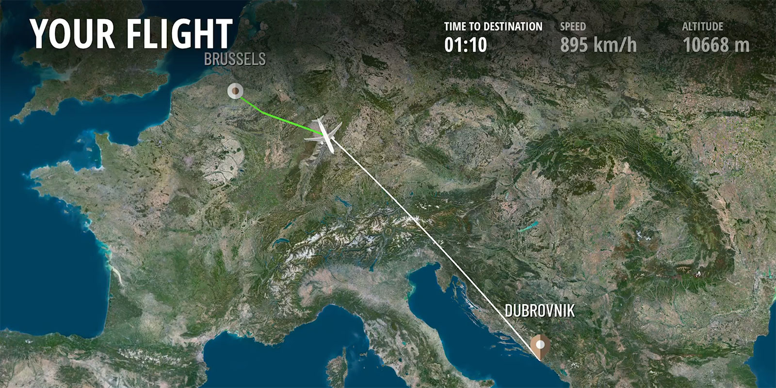
Power your flight simulation and training solutions with the most complete, consistent geospatial data for defence and intelligence. Leverage our satellite imagery and elevation data for creating efficient and reliable 3D landscapes.
Applications:
- Realistic environment building and visualization
- Synthetic environments
- Flight simulation and training- From global scale to local fields of operation
Benefit from imagery in natural colors that accurately depicts the reality of the terrain. Perfect for training and adapted for Full Flight Simulators (FFS).
Beyond the unique quality of our data, we assist you, as a professional satellite imagery provider, throughout your project to ensure satisfaction and peace of mind. We guarantee you a hassle free experience!
Our strengths lie in our flexibility and responsiveness to meet your requirements, delivering tailored data for your projects consistently. Our philosophy is always putting the customer first.
Through firm dedication to R&D, coupled with our 30 years of experience, we stand as a trusted partner and supplier for leading companies situated in Europe, North America, and Japan.

A major player in the Aeronautics industry chose PlanetObserver imagery and elevation data for testbed processes of the Rafale fighter aircraft.

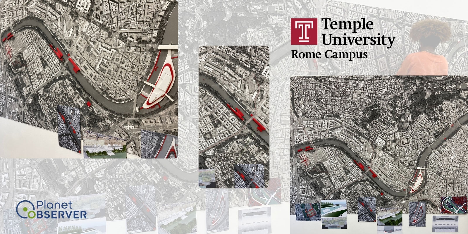
The MOD of Estonia uses PlanetObserver's geospatial data in their Defence and Intelligence solutions.
Read Case Study
The leading American technology company provides PlanetDEM elevation data to key actors of the Defense industry, incl. Collins Aerospace, General Dynamics and Embraer.


The Spanish shipbuilding company used PlanetObserver elevation data for a major project in the Middle East.


Sogitec, subsidiary of Dassault Aviation, uses PlanetObserver imagery and elevation data for flight simulation and training purposes.
Read Case Study

The global leader in the aerospace, defence, and security sectors implements PlanetObserver products for flight simulation and mission preparation systems.
Read Case Study


.jpg)

.png)
